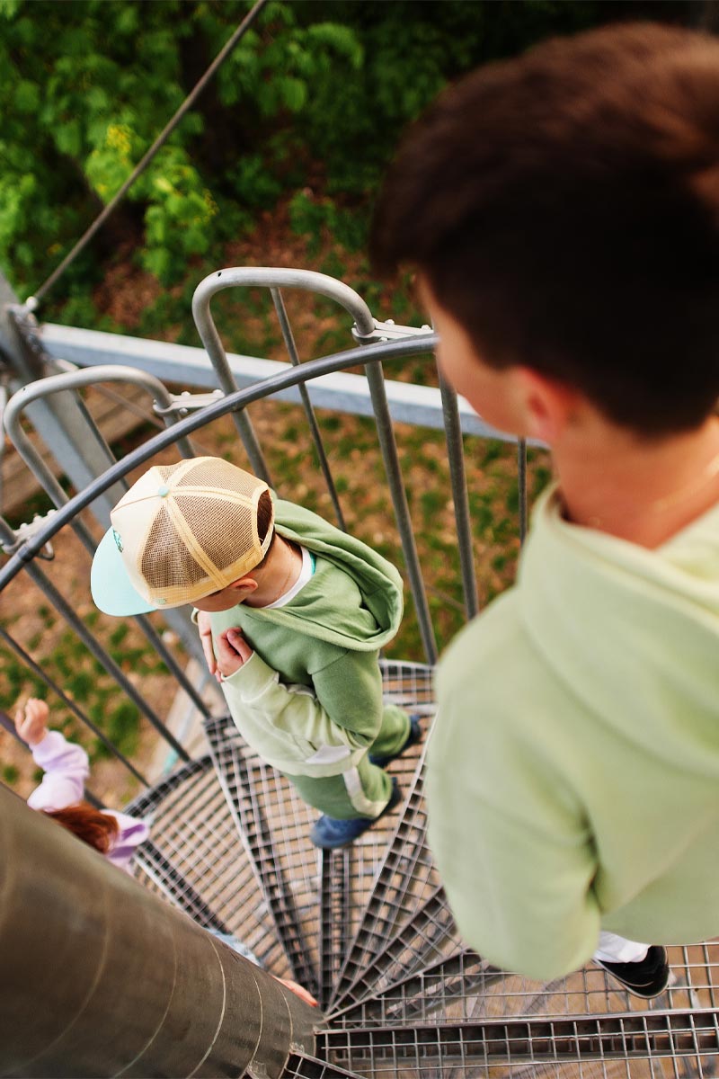
Hiking and places of interest
To the beauty and attractions of the Jizera Mountains.
Hiking trips
Hiking trips
What not to miss
What not to miss
Where to go on your own in the Jizera Mountains
#Bedřichov views
Blue Circle – 4 km
Walking and less demanding; it focuses on learning about the history of Bedřichov (the settlement was founded in 1592), sights (St. Anthony’s Church with the Stations of the Cross, the glassworks, crosses and monuments) and natural or other landscape features in the village (Bedřichov biocorridor, dams).
Vycházka na Černou Nisu
and Nová Louka (14.7 km)
Pension Uko – Bedřichov, stadium (1.5 km) – Bedřichov, game preserve (2.3 km) – Bedřichov dam on Černá Nisa, dam (5.3 km) – Černá Nisa, western crossroads (5, 8 km) – K závorám (7 km) – Závory (7,3 km) – Pod Olivetskou hora (8,3 km) – Za Přehradou (8,6 km) – Gregorův kříž (9,3 km) – Nová Louka (10,2 km) – Bedřichov (13,2 km) – Penzion Uko (14,7 km)
A short excursion route, which will be welcomed by all day visitors to the mountains, will take you from Bedřichov to several key places in the Jizera Mountains. The route from the Bedřichov stadium and further on from the “obora” will take you to the first pearls of the Jizera Mountains, namely the water reservoir on Černá Nisa. On the way to it and behind it, you can see many typical Jizera Mountains monuments, and you can go around the whole dam. From the dam, the route then leads to the second important point of the walk, the former hunting lodge on Nová Louka, sometimes called Šámalka after President Masaryk’s chancellor, JUDr. Přemysl Šámal.
To the natural lookout tower Paličník (17,5 km)
Bílý Potok pod Smrkem, railway station – /Jedlová cesta/ – Sedmitrámový most (4,5 km) – Předěl (7,5 km) – Na Písčinách (9 km) – /Paličníková cesta/ – Pod Klínovým vrchem (11 km) – Paličník (11,4 km) – Bártlova bouda (14,5 km) – Bílý Potok pod Smrkem (17,5 km)
A route of medium length with a significant elevation gain, the possibility of using train transport from Liberec. Follow the Jedlová cesta (red tourist path) to the Sevenfold Bridge, and then along the Šindelový brook to Předěl, from there follow the red path towards Smrk, but turn left at Písčinách. The Paličník trail leads directly to the Paličník hill (944 m) with an exclusive view of the wide region. From Paličník, follow the yellow trail through the valley of the Jizera Mountains National Park and around the rocky banks of the Hájený Brook back through Bártl’s hut (a restaurant with a terrace) to Bílý Potok pod Smrkem.
Kristiánov and the glassmaking monument
in the Jizera Mountains (7 km)
The mountain village of Kristiánov in the Jizera Mountains, not far from Bedřichov (7 km from the Uko guesthouse). In the 18th and 19th centuries, a famous glassworks, of which only the cemetery and the former Liščí bouda inn remained after a fire, where the glassmaking museum was built, one of the highest museums in the Czech Republic (open in the summer season daily 9:00-17:00). You can see the exposition “Kristiánov – the key to the heart of the Jizera Mountains (1775-2005 )” and a wooden model of the former smelter site. The settlement also includes a cemetery with the remains of the owners of the glassworks.
Josefův Důl and Josefodol Dam
Josefův Důl is a village founded in 1701. The old glassworks from the 17th century was replaced by the present one in 1910. The largest dam in the Jizera Mountains, the Josefodol Dam, is situated above the village. It was built in 1976-82 and is the largest reservoir in the Jizera Mountains (area 145 ha), it has two dams, a front one – length 720 m, height 43 m and a side one. They hold 23 million m3 of water.
The water is diverted from the reservoir for processing into drinking water through a 2.5 km long gallery at a depth of up to 130 m underground to the water treatment plant in Bedřichov and further underground to Liberec and Jablonec nad Nisou. As a reservoir of drinking water, the dam and its surroundings belong to a protection zone and bathing is therefore prohibited. Nevertheless, it is a welcome tourist destination, thanks to its beautiful surroundings and well-maintained access roads offering ideal conditions for hiking and cycling.
Red circuit – 5 km
Walking and more demanding; it offers, in addition to the cognitive function (dams, lookout towers, Jizera Mountain huts and views of the Jizera Mountains and the Giant Mountains), also active use of 5 outdoor sports facilities with various exercise elements – trapeze, spring bridge, bench, balance beam and chain bridge.
Both excursion routes pass through peaceful parts of Bedřichov in the Jizera Mountains Protected Landscape Area. The trails cross the main road only three times, on paths and footpaths that have been prepared so that they can comfortably
families with children or school groups can pass through them safely and comfortably.
The individual stops of the Bedřichov views, the circuits start from signboard No. 1 “V Kotli” (near the natural swimming pool), are marked with clear information boards, arrows and maps. Some of the stops are also equipped with resting places with benches, often
with views over Bedřichov and the countryside. There is a brief description of possible activities on the exercise equipment at the sports facilities.
Approximately 200 metres from the Penzion UKO you can join the Bedřichov Views route at signpost No. 6, which belongs to the red route and takes you further into Bedřichov, where the route can be freely combined and changed.
To the waterfalls of the Black Stream
and to the natural lookout tower
Frýdlantské cimbuří (12 km)
Bílý Potok pod Smrkem, railway station – U Liščí chaty (2 km) – Kámen liberení (3 km) – Hajní kostel (3.7 km) – Pod Frýdlantským cimbuřím (5 km) – Frýdlantské cimbuří (5, 3 km) – Polední Kameny (6 km) – Pavlova cesta (7 km), turn left – /Pavlova cesta/ – Štolpišská cesta (10,5 km) – /Štolpišská cesta/ – Smědava (12 km)
A short hiking route suitable for everyone without significant health problems, please note the higher altitude and physical stress during the journey! It is possible to use train transport from Liberec. One of the few routes where you will not meet bicycles, but you will see “chains” like in the Tatras! The starting point is Bílý Potok below Smrkem, from where you will slowly climb up the most accessible paths to the heart of the Jizera Mountains, to Smědava. The first stops can be the waterfalls on the Černý Potok, then the climb to the Hajní kostel, followed by views of Frýdlant and the surrounding area from the Frýdlant Cimber. The next part of the trip will be in a calmer pace of moderate terrain, from Polední kamen to Pavlova cesta – but here do not continue on the marked yellow, but go around Smědavská hora from the northern part. The trained eye will not miss the remains of the air crash. From Pavlova cesta you will then reach the Štolpišská road leading to Smědava.
Jizerka and the peat bogs of Jizerka
The settlement of Jizerka in the northeastern Jizera Mountains was first mentioned in the 16th century, and in the mid-19th century two glassworks were founded here, one of which is still in use today. Near Jizerka there is a peat bog situated 860 m above sea level. The Jizerka Peat Bog National Nature Reserve has been included by UNESCO in the network of the most important European reserves.
The Jizera River flows through the centre of the Great Jizera Meadow, which also forms the state border with Poland. Above the village of Jizerka rises the unique basalt cone hill Bukovec. A nature trail passes through the area of the reserve. In the village of Jizerka there is a museum with an exposition about the history and present of the Jizera Mountains – open May-October on weekends, 9:00-16:00.
Waterfalls on the Black
and Hejnicky Ridge
in the Jizera Mountains
The waterfalls on the Black Stream are the most powerful waterfalls in the Jizera Mountains. The Black Stream, whose two sources run through the Hejnice Ridge and then through a rock gorge, has a 500 m drop over 3 kilometres. The whole area is part of the Frýdlantské Cimbuří reserve, which was named after a massive rock formation towering above the gorge in the Polední Kameny ridge.
Easy routes that even children can handle
Church of St. Anthony (500 m)
Built in 1930-1932. Reconstructed in 2005, in 2008 a cross path and landscaping of the surroundings were built. Services are held here in the summer months and Christmas carols in December. 500 m from the Uko guesthouse.
Královka Lookout Tower (1.5 km)
One of the most famous lookout towers in the Jizera Mountains, which rises above Bedřichov on the hill of the same name (859 m). The original wooden building from the end of the 19th century was rebuilt into a new stone lookout tower in 1906. Its height is 23.5 m. In 1934 a large mountain house was added to the lookout tower – now the Královka restaurant. 1.5 km from the Uko guesthouse.
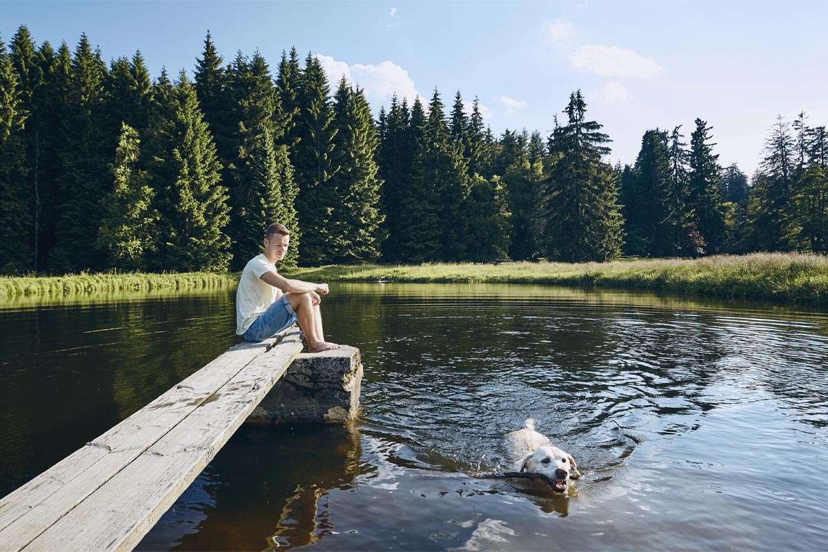
Bedřichov Dam
on the Black Neisse (5 km)
The dam was built in 1902-1905 and covers an area of about 42 hectares. The average depth is about 15 m. Due to its location and the surrounding landscape, the dam is a popular tourist destination. In summer it offers the possibility of quiet swimming, in winter (under suitable conditions) it is possible to cross-country ski on its frozen surface. It is 5 km from the Uko guesthouse.
The Way of the Cross at Vysoké
Ridge (2 km)
A romantic place hidden in the woods above Bedřichov. The forest fountain and the Stations of the Cross, built in 1878, now serve as a place of rest, meditation and an interesting tourist destination. 2 km from the Uko guesthouse.
Nová Louka (4 km)
Valley peat bog at 770 m above sea level with a hunting lodge – Šámalova chata, on both banks of the Blatný Brook. The area has been declared a state nature reserve. Originally a glassworks and the manor house of the owner of the glassworks were converted into a hunting lodge by the then owners of the estate after 1844. Today there is a mountain hotel with a restaurant. Nová Louka is an important crossroads of several hiking trails and is widely visited throughout the year. It is 4 km from the Uko guesthouse.
What not to miss

Lookout towers
The Lighthouse of Jára Cimrman
The construction of the museum and the Lighthouse was completed in 2013 according to the project of the architect Professor Martin Rajniš and is a great example of the so-called natural architecture. The building is half built into the hillside and is clad in locally quarried stone. The tower itself is built of pine wood with an oak staircase, its original construction is very airy and its silhouette truly resembles a lighthouse. The whole building fits perfectly into the hilly landscape of Příchovice near the historic building U Čápa.
Královka lookout tower
The Královka lookout tower stands directly above Bedřichov, the shortest way is directly from the Uko guesthouse along the tourist trail to the top, where it is about 1.5 km, with an elevation of about 150 m. Next to the Královka lookout tower is the Královka hotel with a restaurant.
Slovanka lookout tower
Access to the Slovanka lookout tower is from the centre of Hrabětice, along the green tourist trail. It is our oldest iron lookout tower, weighing nearly 5.5 tons. It has been declared a state-protected technical monument by the Ministry of Culture of the Czech Republic. In 2003, the tower on Slovanka was depicted on a postage stamp.
Spruce Lookout Tower
The shortest way (about 7 km) to the top of Smrk is on foot from the Smědava cottage. The metal lookout tower has a shelter for about 25 people – a place where people can hide from the bad weather. The lookout tower also serves Polish tourists – there is a border crossing right on Smrk. From the Polish spa Swieradow Zdrój it is 12 km to Smrk. In good weather, you can see 150 kilometres from the lookout tower’s gallery. In addition to the Jizera Mountains, visitors can see the Krkonoše Mountains, the Lusatian Mountains, Ještěd, Bezděz and even Říp. A view of Poland will also open up.
Lookout tower Špičák
The lookout tower can be reached by going from Albrechtice in the Jizera Mountains along the blue hiking trail, which then turns green (about 2 km in total).
Štěpánka lookout tower
The Štěpánka lookout tower stands on Hvězda Hill, which rises about 4 kilometres east of Tanvald. Follow road No. 10 to the beginning of Kořenov, where you turn to Příchovice. After 2 km in Příchovice, turn left at a large tree onto a narrow road climbing uphill (there is a signpost) until you reach the Hvězda cottage, where you can park. From there you follow the blue trail to the top, about 300 m away, the elevation is about 50 m.
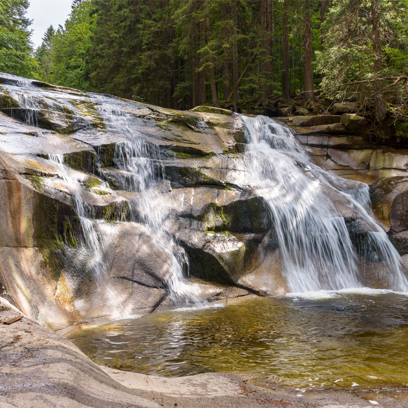
Waterfalls
Black Desná
One of our wildest rivers, the Černá Desná, rises in the heart of the Jizera Mountains. Between the Souš dam and the town of Desná, it creates three beautiful waterfalls with a flow of more than half a cubic meter and an equal number of cascades stretching several hundred meters.
Štolpich
Another impressive scenery can be seen on the slopes of the rocky massif of Ořešník on the way along the red trail from Hejnice to Holubník. The Sloupský brook descends approximately 30m down the rock wall, where you will find a series of cascades and waterfalls, collectively called the Velký (or also Černý) Štolpich. There is a similar system on the Small (White) Stolpich.
Jedlová
The most famous and probably the most visited waterfall in the Jizera Mountains is located on the Jedlový potok. Thanks to the preserved original stands of fir and beech trees, the whole valley is declared a nature reserve with an area of 12 hectares.
# Jizera Mountains are TOP even in summer
Water reservoirs
Josefův Důl Dam
The Josefův Důl water reservoir is located at 760 m above sea level and was built in 1976-1982 on the Kamenice River approximately 2 km above the village of Josefův Důl. Its area is the largest dam in the Jizera Mountains. The dam is 720 m long, 43 m high and holds 23 million m3 of water (more than all other Jizera Mountain dams combined).
The dam is intended primarily to supply the Liberec and Jablonec regions with drinking water, to generate electricity in a small hydroelectric power plant and as a flood protection. Near the dam, there is a 60-metre-high intake tower, from which an underground tunnel 2440 metres long leads, which extends up to a hundred and thirty metres below the mountain ridge and ends in the water treatment plant in Bedřichov, just below the Uko guesthouse.
Souš Dam
The Souš Valley Dam was built in 1915 on the Černá Desná River. Its dam is filled, 21 m high and 364 m long. The water surface covers an area of about 86 hectares. It was named after the village of Souš, part of which is now located below the dam.
The dam was converted into a drinking water reservoir for the Jablonec, Tanvald and Železnobrod regions in 1974. Swimming and fishing are therefore forbidden here and the surrounding area is strictly protected.
Around the Souš there is the repaired Soušská road, which allows cars to get across the Smědava River to Bílý Potok and Hejnice on the other side of the mountains, but only during the summer season from May to October. In winter the road is closed.
Mountain peaks
Bramberk
787 mn.m. – distance from the pension 8,2 km by car, 7,8 km on foot
Lučany nad Nisou
21 m high granite tower opened to the public in 1912
Černá hora
1085 m above sea level – distance from the guesthouse 8.6 km by car, 10.3 km on foot. It is a double peak, the higher peak is Černá hora (1085 m, old name Černá hora kristiánovská) and the lower peak is Sněžné věžičky (1070 m, old name Černá hora hejnická), which are about 1 km northeast of Černá hora. In the saddle between the two peaks lies the highest peat bog in the Czech part of the mountain range.
Jizera
1122 m above sea level – distance from the guesthouse 28 km – by car, 14.1 km on foot. The second highest mountain in the Czech part of the Jizera Mountains and also the highest peak of the Hejnice Ridge and the entire Jizera Mountains. It is also the mountain with the highest prominence (elevation from the saddle) of all the thousands in the Czech part of the mountains.
Olivet Mountain
886 m above sea level – distance from the guesthouse 7.3 km on foot. The blue hiking trail leads through it on a paved road and the Jizera skiing trail also runs along its route. The New Pilgrimage Route also passes through here, leading pilgrims from Liberec to Hejnice to the local Church of the Visitation of the Virgin Mary. On its eastern slope, the Černá Nisa River rises and the Jeřice River flows around the peak from the west. To the northeast of the peak there is a signpost of hiking trails named “Bílá kuchyně – crossroads”, to the southeast “Pod Olivetskou hora” and to the southwest “Závory”.
Petřín
635 m above sea level – distance from the guesthouse 11.7 km by car, 14.3 km on foot. Jablonec nad Nisou, panoramic restaurant with 20 m high lookout tower, wine bar, hotel
Smědava Mountain
1 083,9 m above sea level – distance from the guesthouse 30,6 km by car, 15,6 km on foot. The high mountain is situated in a side spur of the Hejnice ridge of the Jizera Mountains. The mountain is probably named after the Smědá River, which has one of its sources in the peat bogs below the southern slope. Below the mountain there is a mountain enclave and the Smědava cottage. About 700 metres southeast of the summit is the Vlčí louka nature reserve. On the summit there is the Blueberry Stone, on which a box with the summit book from 1976 is located.
Bukovec
1005 m above sea level – distance from the guesthouse 28 km by car, 20.7 km on foot. Bukovec is a distinctive basalt hill on the eastern edge of the Jizera Mountains, in the Jablonec nad Nisou district. With its distinctive conical shape it dominates the mountain village of Jizerka. Thanks to the basalt bedrock, a rich flora has developed on the hill. The attractions of the local nature are described in the nature trail. In good weather, you can also see the western part of the Giant Mountains from the top. Bukovec is one of the largest basalt piles in Europe.
Frýdlant dulcimer
900 m above sea level – distance from the guesthouse 38 km by car, 13.5 km on foot. An important rock group in the central part of the Polední kameny ridge in the Jizera Mountains. The name is supposed to remind the similarity of the rocks with the jagged battlements of the Frýdlant castle. Until 1999, there was a national nature reserve of the same name in the vicinity of the rocks, but today this area is part of the Jizera Mountains Beeches National Nature Reserve. The rocks are also important climbing terrain.
Holubník
999 m above sea level – distance from the guesthouse 38 km by car, 10.8 km on foot. The mountain is situated in North Bohemia in the middle of the Hejnický Ridge in the Jizera Mountains. Holubník is accessible by a red marked hiking trail connecting Ptačí kupy (1013 m) and the Holubník saddle (999 m). The Štolpišská road runs along the northern slope of the peak and the Nová cesta runs along the southern slope.
Nekraš (Královka)
859 m above sea level – distance from the guesthouse 2.7 km by car, 1.4 km on foot. The highest point of the Maxovský ridge. Lookout tower (23.5 m high) from 1907, below it there is a cottage from 1936. The name Královka is a corruption of the original German name König’s Heights. The oldest Czech name of the peak is Nekraš.
Ořešník
800 m above sea level – distance from the guesthouse 14 km on foot, 39 km by car. The rocky outcrop of the lateral part of the Hejnice ridge of the Jizera Mountains. It rises steeply to a height of 800 metres above the valleys of Velký Štolpich and Smědá. This massive granite block got its name from the hazel trees that covered its surroundings about 800 years ago, when the first colonists came here.
Smrk
1124 m above sea level – distance from the guesthouse 49.5 km by car, 21.7 km on foot. With a height of 1,124 metres above sea level, it is the highest mountain in the Smrčská hornatina and also in the Czech part of the Jizera Mountains. The borders of the three provinces of Bohemia, Lusatia and Silesia have been meeting here since time immemorial. Today there is a pedestrian border crossing to Poland and in 2003 a lookout tower was rebuilt here. The Polish peak Smrek is 1123 metres high and lies just over the Czech-Polish border. The Jizera River rises on the southern slopes of the mountain, and the Klečoviště na Smrek natural monument is located near the summit, on the western slope of the mountain.